Entlebuch Passes Route


- 9:20 h
- 113.69 km
- 2,356 m
- 2,356 m
- 472 m
- 1,610 m
- 1,138 m
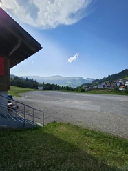
- Start: Sörenberg
- Destination: Sörenberg
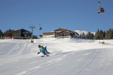
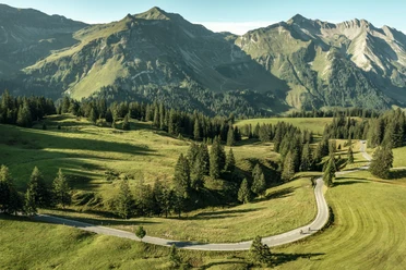
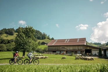
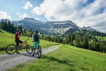
The route starts in the village of Sörenberg and soon rises steeply up to the Glaubenbielen pass. Bet you don’t even realize the steep ascent? The beautiful landscape offers great views along the way. Once at the top, you will be thrilled by the view of Lake Sarnen. You will quickly forget the effort - promised. Now it goes down to Giswil and then along Lake Sarnen to Sarnen, where a break by the lake is more than deserved. From Sarnen, the route goes via Stalden back uphill to the second pass, Glaubenberg. Pay special attention here to the many cattle grids. On the Obwalden side, you might encounter some cows on the road. Just before the pass summit, there are several restaurants, for example the Berghotel Langis or the mountain restaurant Schwendi-Kaltbad. Also at the pass summit, you find the Passhöchi Beizli amidst enchanting moorland. The moorland "Glaubenberg" is part of the Federal Inventory of Moorlands of especial beauty and national significance. It is the largest in Switzerland and extends between the Pilatus chain in the north and the Glaubenbielen pass in the south over 130 square kilometers – somewhat larger than Lake Lucerne. From there it goes downhill again via Gfellen and Finsterwald to Entlebuch. Here you follow the Emme river toward Schüpfheim before the final climb – the starting point of this route is again in the village of Sörenberg.
Waypoints
Good to know
Pavements
Best to visit
Directions
Sörenberg - Glaubenbielen - Giswil - Wilen - Sarnen - Stalden - Glaubenberg - Entlebuch - Schüpfheim - Flühli - Sörenberg
The route follows the national and regional Veloland routes of SchweizMobil:
N4 Sörenberg – Sarnen, R73 Sarnen – Entlebuch, R24 Entlebuch – Schüpfheim, N4 Schüpfheim – Sörenberg
Tour information
Loop Road
Nature Highlight
Stop at an Inn
Equipment
Wear the right protective gear, assess your skills properly, yield to hikers, stay on the trail and close pasture fences! Refer to the Central Switzerland Bike Code – this way you remain welcome on your mountain bike!
Directions & Parking facilities
The UNESCO Biosphere Entlebuch lies in the heart of Switzerland, centrally located between Bern and Lucerne. You can reach Sörenberg via main road 10 towards Schüpfheim and from there to Flühli Sörenberg. From Giswil via the panoramic road / Glaubenbielen pass to Sörenberg.
Plan your route using the Google route planner.
You can reach Sörenberg by public transport via Schüpfheim (Bern-Lucerne train line). From Schüpfheim, take the PostBus to Sörenberg "Post".
Plan your trip with the SBB online timetable.
Additional information
UNESCO Biosphere Entlebuch
c/o Biosphere Center
Chlosterbüel 28
6170 Schüpfheim
Phone +41 (0)41 485 88 50
www.biosphaere.ch
Literature
You can get the brochures "Bike Guide" and "Lucerne bike map" at the Biosphere Center or in the brochure shop on www.biosphaere.ch
Author
UNESCO Biosphäre Entlebuch
Organization
UNESCO Biosphäre Entlebuch
License (master data)
UNESCO Biosphäre Entlebuch

Author´s Tip / Recommendation of the author
Nearby


")

Download GPX file