Multi-day hike from Pilatus Kulm over Mittaggüpfi to Sörenberg


- 18:38 h
- 43.12 km
- 2,384 m
- 3,296 m
- 1,020 m
- 2,101 m
- 1,081 m
- Start: Pilatus Kulm
- Destination: Sörenberg
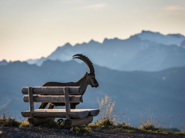
The journey to Pilatus is already spectacular. Take the boat from Lucerne to Alpnachstad, then the steepest cogwheel railway in the world to Pilatus Kulm. With hiking boots laced up, start the three-day hike first heading towards Mittaggüpfi. A large part of the white-red marked hike consists of ridge walks with views from the Central Plateau over the Jura to the Bernese Alps. The varied hike also passes rugged rocks, marshy high plateaus, and evergreen valleys. Watch ibex colonies between Tomlishorn and Widderfeld as well as at Stäfeliflue and enjoy refreshing moments during the river hike in the Schlierental. Difficult spots are secured with chains.

Waypoints
Good to know
Pavements
Best to visit
Directions
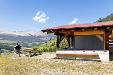
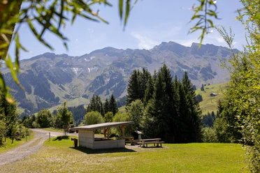
From Pilatus Kulm, hike to the Tomlishorn, the highest point of the multi-day hike at 2128 meters above sea level. The next section to Widderfeld is steep and partly secured with chains. Take breaks along the way and look out for the ibex colonies often seen in this area. Then, ascents and descents as well as ridge walks alternate through a marshy high plateau to Mittaggüpfi at 1916 meters above sea level. From there, enjoy the 360-degree panoramic view stretching from the Central Plateau to the Jura. To the southwest, you can see as far as the Schreckhorn and Mönch of the Bernese Alps. A secured descent with chains and wooden ladders leads to the Tripolihütte. The shelter is open year-round, and from mid-May to the end of October, on fine Sundays, you can meet the hut wardens. Refresh yourself with a soup or a cozy coffee. The varied route continues to the Stäfeliflue, another hotspot for ibex. The last part of the first stage is continuously downhill to Gfellen, where an overnight stay is recommended.
The next day, hike via Oberbrüederemättli to Lauenberg. The trail then leads down into the Schlierental. The section between Oberschlierental and Schwendi Kaltbad follows the river, providing a welcome change from many ridge walks. You can stay overnight at the Schwendi Kaltbad mountain restaurant or continue a short way to the Berghotel Langis.
After hiking over the Glaubenberg Pass the following day, a ridge walk between Sewenegg and Nünalpstock awaits. The final part of the multi-day hike is a long descent from 1900 to just under 1200 meters above sea level, leading to the destination of Sörenberg. Treat yourself to a few quiet hours in Sörenberg and stay overnight in an accommodation that suits you before returning by public transport to Lucerne, Kriens, or Alpnachstad.
Tour information
Climbing Site
Equipment
- Sturdy footwear recommended
- Bring enough water and snacks
Directions & Parking facilities
Arrival with the Pilatus Railways to Pilatus Kulm.
Return trip from Sörenberg with public transport.
Additional information
Between Mittaggüpfi and Gfellen there is the Tripolihütte shelter
A reservation for overnight stays is recommended:
Pilatus Kulm:
Hotel Pilatus-Kulm****Superior
Gfellen:
Schwendi Kaltbad:
Bergrestaurant Schwendi Kaltbad
Langis:
Sörenberg:
Author
Luzern Tourismus
Organization
Lucerne Tourisme
License (master data)
Luzern Tourismus

Author´s Tip / Recommendation of the author
- Stay overnight at Pilatus Kulm.
- Start the hike early in the morning and keep an eye out for the ibex that live on Pilatus.
Safety guidelines
- Only for experienced hikers with good fitness and surefootedness
- Many long and exposed high trails
- Difficult sections are secured with chains
- The ridge trail is only passable from July to October
Social Media
Nearby


